Today we decided to return to the River Wye and walk some more of its dales. We set off to Monsal Head to start the walk. Monsal Head stands on hills overlooking a bend in the river and also looks down on the old railway viaduct which now carries part of the Monsal Trail.
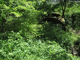
We descended from the Head down a woody path towards Monsal Weir and here we crossed the river and started to follow it downstream through Monsal Vale It was a lovely sunny day although there was quite a breeze which kept things nice and cool for walking. The path followed the river, sometimes leaving it for a while but always returning to it again, there were lots of wild flowers in bloom, needless to say I don't really know what they were except the bluebells, I really must buy a book. We even stumbled on a tiny overgrown water wheel.
After a pleasant walk we then left the river and crossed the busy A6 at White Lodge and started a long climb up towards Taddington village. The route followed a rocky path up a valley called Dimin Dale before emerging at the top into farmland and we then followed a farm drive into the village. We approached Taddington from the opposite end from last week and no soon had we reached the village we turned away from it to walk back down to meet the A6 again.
We crossed the road again and followed a bridle way which led us to High Dale. This is a narrow V shape Dale and at around halfway through the walk we stopped to eat lunch. We walked through High Dale until we took a path up the side of the dale and after crossing farmland we found ourselves high above the Wye where it runs through Miller's Dale. The view from here was quite magnificent not only could we look down into the Dale where we could see steep limestone cliffs but also towards the horizon and the hills of the northern part of the Peaks.
We descended into the dale and having crossed the Monsal Trail we paused on a bridge crossing the river, where the water was so clear we could see trout in the river, we could even see them rising to catch food.
We then walked into the yard of the once infamous Litton Mill, which was notorious in the 19th century for abusing child labourers.
Leaving the mill behind up we continued along the banks of the Wye again, stopping to watch the birdlife on the water, some Moorhens were behaving very strangely I can only assuming it was part of the mating ritual. We saw several Dippers, one of my favourite birds, also a family of swans with very small cygnets.
We continued though the steep limestone sided valley and entered the quaintly named Water-cum-Jolly Dale as we neared Cressbrook.
Here the river widens considerable by a large granite wall known as the Rubicon Wall where we briefly stopped to watch a rock climber negotiate a large overhang.
We then crossed the river over a fast running weir and started to climb the side of the dale
overlooking Cressbrook Mill. Cressbrook Mill is quite a grand building complete with a cupola on top. Like Litton Mill, Cressbrook has now been converted into apartments and would certainly be lovely place to live.
The path left the river and took us up to the Monsal Trail. The Monsal Trail follows the bed of a now closed railway and runs for about 8.5 miles from near Bakewell to Topley Pike 3 miles from Buxton, it travels through several tunnels. We followed the trail from Cressbrook tunnel over the Monsal Dale Viaduct, before leaving it just before the Headstone Tunnel, below Monsal Head.
We then ascended the valley to arrive back at our starting point.
This was on of the nicest and most diverse walks we have done, and at 7 miles also one of the longest, but as usual we took our time and were out for 5 and a half hours


